Pilot Catchment in Slovakia
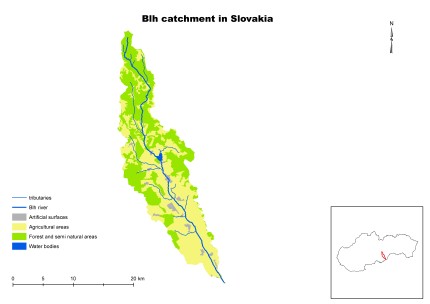
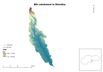
The Slaná river basin is affected by floods, there have been identified 31 geographical areas with significant flood risk which are connected with 8 water bodies. In the catchment exist quite strong potential for applying NWRMs in the landscape to mitigate the negative impact of floods. The southern part of the Slaná RB is assessed as vulnerable to fluctuation of discharges potentially caused by climate change. The most important impacts on water bodies’ status are change of biotopes due to hydromorphological changes, organic pollution, contamination due to priority and relevant substances and eutrophication due to nutrient pollution. There are localities suitable for water retention, 4 water bodies have been determined to be affected by significant disruption of lateral connectivity and for 6 water bodies the potential of reconnection was identified. Within the FramWat project we will focus on the subcatchment of Blh river.
These problems are handled in the national strategic and planning documents as River Basin Management Plans (2009, update 2015), Flood Risk Management Plans (2015), National Climate Programme (since 1993), Adaptation strategy of the SR for negative impacts of climate change (2014, update 2017) and Wetlands management programmes (2008 – 2014, update 2015 – 2021) and its Action Plans (2008 – 2011, 2012 – 2014, 2015 – 2018).
| Characteristic | Unit | Value |
| Character of catchment | fan-shaped river network with surface of plains to higher highlands dissection | |
| Catchment size: | km2 | 3217 |
| Average flow low/avg/high* | m3/s | 19,355 (avg) |
| Extreme flow low/high** | m3/s | Qmin = 2,426/Qmax = 470 |
| Annual precipitation low/avg/high*** | mm | 568/823/1215 |
| Annual air temperature min/avg/max**** | ºC | 3/7/10 |
| Agriculture area | % | 40,02 |
| Urban area | % | 3,08 |
| Forest area | % | 56,78 |
| Open Water area | % | 0,12 |
| Flooded area (1/100 years) | km2 | 63 |
| Artificial drainage area | km2 | |
| Ecological status no good/bad | water body | generally medium/bad |
| Major problems to achieve good ecological status | Phytobenthos, Macrophytes, NH4, PO4, Norganic |
* From multiannual statistic 1961 - 2000
** From multiannual statistic 2005 - 2010
*** From multiannual statistic 1981 - 2010
**** From multiannual statistic 1961 - 2010
Within the pilot action the valorization method for identification of potential N(S)WRM localities and the static tool for assessing the cumulative effectiveness of N(S)WRM and the other developed tools will be tested. Among others the expected lessons learned are whether the wider application of developed tools in the different catchments is possible, the usability of the developed tools for different kinds of stakeholders and their objectives. Based on the testing results, all the tools will be improved.
The main outcome of the project is to promote implementation of N(S)WRM in the river basins and to promote their multifunctional effect too. Decision Support System (DSS) which will integrate all the developed tools and will be accessible through web, will contain also the manual on assessing the effectiveness of N(S)WRM and guidelines to improve water balance and nutrient mitigation by applying system of N(S)WRM, which will be prepared based on testing results and consultations with stakeholders during the national dialogues or regional workshops.


