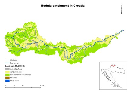
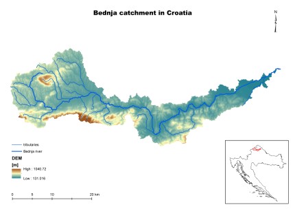
Bednja Catchment in Croatia
The Bednja river basin was chosen because of a serious problem caused by torrents forming after intensive rainfall, causing the movement and transport of significant sediment quantities into the lowland parts of the watercourse. It is common that torrents are accompanied by landslides. According to Natura 2000, in the Bednja basin there are 14 sites important for the conservation of endangered species and a total of 12 sites with different levels of protection. The most important road in the basin is a section of the motorway cutting the basin into two parts slightly further downstream of the natural borderline between the upland and lowland parts of the basin. Its major part was built on an embankment with several culverts causing obstacles for the flow of high waters of Bednja and its tributaries.
The Project activities should comply with the measures proposed by the River Basin Management Plan and the Flood Risk Management Plan (July 2016).
| Characteristic | Unit | Value |
| Character of catchment | lowland 30%/low hills 70% | |
| Catchment size: | km2 | 616 |
| Average flow low/avg/high* | m3/s | 0.8/7/77 |
| Extreme flow low/high* | m3/s | 0.003/179 |
| Annual precipitation low/avg/high** | mm | 481/931/1312 |
| Annual air temperature min/avg/max** | ºC | 10.4 (avg) |
| Agriculture area | % | 30 |
| Urban area | % | 2 |
| Forest area | % | 49 |
| Open Water area | % | 0.1 |
| Flooded area (1/100 years) | km2 | 37.7 |
| Artificial drainage area | km2 | |
| Ecological status no good/bad | water body | 6 water bodies / 2(bad), 3 (moderate), 1 (good) |
| Major problems to achieve good ecological status | Phytobenthos, Macrophytes, Macrozoobenthos, Total N and Total P |
* From multiannual statistic 1949-2016
** From multiannual statistic 2007-2016
The main objective of this project is the strengthening of a regional framework for the mitigation of floods, droughts and pollution with the application of Natural Small Water Retention Measures (NSWRM). This activity is focused on defining sustainable measures through the development of methods which will be based on the exploitation of natural (landscape) characteristics and small water retention. Ultimately, the purpose is the application of gained knowledge in river basin management. Such an approach will greatly improve the water balance and reduce sediment transport and retention of nutrients within the basin.
The expected outcome should be the definition and description of a new approach to the implementation of NSWRMs in the River Basin Management Plans. Water management and environmental protection often clash, and better cooperation between these two sectors needs to be established. In the achievement of these objectives it is necessary to define multifunctional NSWRMs as well as the framework for the improvement of water balance and mitigation of nutrient input with the application of NSWRMs in order to define their application in Croatia. A catalogue of practicable measures that can be applied to watercourses in Croatia needs to be prepared as well.


